New - 2 Days Ago
$489,990
Active
4
Beds
3
Baths
2472
Sqft
0.23
Acres
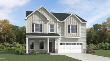
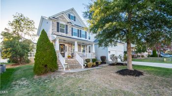
344 Pale Morning Dr, Rolesville, NC 27587
MLS#: 10201868



Drive along Main Street in Rolesville, and you'll see a town in the middle of a transition. Older roadside businesses share the corridor with newer commercial buildings. Around Main and Young streets, rental housing and retail space are bringing new activity to the town center. Farther south, a Publix has changed where residents can make their regular grocery runs.
Turn off the main roads, and the picture changes again. Some neighborhoods have established streets and landscaping. Others are still taking shape, with homes occupied in one phase and construction continuing in another. Beyond the larger developments, properties may offer more land but come with different utility, road, and maintenance responsibilities.
That's what makes living in Rolesville, North Carolina, an interesting choice. It's not just a question of whether you like a small town near Raleigh. It's about which part of town fits your daily routine and what kind of homeownership experience you want.
Rolesville is its own municipality in northeastern Wake County, separate from nearby Wake Forest. The two towns share regional destinations, but they have different commercial centers, development patterns, and municipal boundaries.
Understanding those differences is a good place to begin.
For years, U.S. 401 carried through-traffic along Main Street in Rolesville. Roadside businesses, driveways, and intersections reflect that history as a route for passing drivers.
When the U.S. 401 Bypass redirected traffic, the town gained an opportunity to rethink Main Street. Its downtown vision addresses a multi-mile corridor rather than a compact historic shopping district.
Major streetscape improvements have included sidewalks, curbing, streetlights, and trees. The work is intended to support a more connected, pedestrian-oriented environment, although individual stretches of Main Street still differ in their commercial layout and ease of access.
In a September 6, 2026 town traffic notice, Rolesville expected intermittent daytime lane closures from September 9 through the end of September for remaining work. If you're driving Main Street in October, check current traffic notices rather than assuming those closures are still in place—or that all work is finished.
The improvements also shouldn't be interpreted as a guarantee of higher property values, better safety outcomes, or equally convenient walking conditions for every nearby home.
What they do show is how Rolesville is trying to change the relationship between its roads, businesses, and residential areas.
At Main and Young streets, Cobblestone Village combines multifamily rental housing with commercial space near one of Rolesville's central intersections.
For someone who wants to live near developing commercial activity, the location is worth exploring. The surrounding street network and the actual businesses operating there matter more, however, than the mixed-use designation alone.
Consider a home that's relatively close to the intersection. If reaching a favorite business requires crossing Main Street or navigating several commercial driveways, the experience may be different from what the distance suggests.
The town's Cobblestone Village project record provides the development background.
Farther south, Wallbrook represents another change in Rolesville's commercial landscape.
Publix opened at 821 South Main Street in 2025, giving residents a major grocery option along the corridor. Other commercial spaces are part of the development, although businesses listed as coming soon or fitting out their premises shouldn't be treated as already operating.
That distinction is useful when comparing a nearby home. A grocery store that's open today can immediately change someone's weekly routine. A planned restaurant or retailer may eventually add convenience, but its timing and eventual operation are uncertain.
Wallbrook also has a residential component that illustrates a common mistake in new-construction searches.
Although the buildings look like conventional townhomes, the town's Wallbrook development record describes them as a for-lease community, with Lennar-built structures owned by a rental operating entity. Their appearance doesn't mean the individual homes are available to purchase.
The town separately documented the Publix opening.
A home near Wallbrook may provide convenient access to shopping without necessarily providing a practical walking route. Public access to commercial businesses also doesn't confer rights to private residential amenities.
For someone relocating, the useful question isn't simply whether a neighborhood is close to Main Street. It's which parts of Main Street they'd actually use and how they would get there.
Main Street helps explain the town's direction, but the residential areas reveal why one Rolesville home can differ substantially from another.
Established settings such as Carlton Pointe, Granite Falls, Cedar Lakes, and Village at Rolesville offer opportunities to examine existing neighborhood conditions. Newer communities, including Parker Ridge, The Point, and Kalas Falls, introduce additional questions about development phases, construction activity, and planned facilities.
Neither setting is inherently the better choice. Established streets let you judge the surroundings as they function today; newer construction may involve work still underway. In a developing neighborhood, a recorded subdivision map or approved plan can tell you what's laid out or authorized without showing that every road or amenity is ready to use.
Those differences become clearer when you look at individual communities.
Carlton Pointe illustrates why a neighborhood name isn't enough to describe the ownership experience.
The broader area includes detached homes, while The Townes at Carlton Pointe adds attached housing to the planned community.
According to the town's project record, site work for the townhome addition began in 2020, with building construction following in late 2022. Its recorded final plat—a subdivision map filed in public records—identifies townhome lots, common and open-space areas, and public rights-of-way, or land designated for public streets.
Imagine comparing a detached house with a yard to a townhome nearby. The detached house may involve more direct landscape and exterior maintenance. The townhome may place some responsibilities with an association, but it could also carry different assessments or exterior-use restrictions.
Even if both homes share the Carlton Pointe name, that doesn't establish identical maintenance obligations or rights to community amenities.
The practical difference is in the recorded documents and the particular property, not simply the neighborhood sign.
Parker Ridge is east of South Main Street, along both sides of Redford Place Drive. It sits behind the Food Lion shopping plaza and elementary-school area, west of Village at Rolesville and Cedar Lakes.
That setting provides a useful comparison between nearby established destinations and a subdivision developing through multiple phases.
Parker Ridge includes detached homes, townhomes, recorded common areas, and an approved amenity-center plan. Town infrastructure records also identify a connection toward Young Street.
For a particular home, look at the occupied streets, the construction still nearby, and the entrance available today. Is the amenity center operating, and can drivers use the Young Street connection yet? Those answers will tell you more about daily errands than the overall development plan.
Those milestones are documented in the Parker Ridge project record.
The Point is a large phased residential development on both sides of the U.S. 401 Bypass. It includes detached-home and townhome components, with separate north and south approvals.
The town documents the development's 2021 annexation, followed by phase-specific plats (recorded subdivision maps for individual sections), revised boundaries, common areas, infrastructure guarantees (financial security for completing required infrastructure, not proof that it is already built), and land identified for future development.
At this scale, the particular phase and entrance matter. An occupied section may feel different from one beside remaining construction, and the available exit can shape the route to work, school, or shopping. Follow streets and trails that are actually open, then check the phase's finished infrastructure and recorded obligations; a proposed connection on the master plan isn't a shortcut yet.
The town's Point approvals page provides the development history.
Kalas Falls provides another example of why construction milestones matter.
The town's records identify detached-home phases and a townhome phase involving different builders and owners. Construction of Phase 1 houses began in 2025.
On June 29, 2026, the town recorded Raleigh Water acceptance as a condition for Phase 2 residential building permits. A later entry said Phase 2 house construction could begin following its July 1, 2026 preconstruction meeting. If you're considering that phase, check current utility acceptance, permits, and construction rather than assuming the June condition still blocks every home.
An amenity-center site plan received Town, County, and Raleigh approvals in 2026. Ask which facilities are actually operating for the home you're considering; the different Kalas Falls phases may not be at the same stage.
The Kalas Falls project record contains the town's approvals and construction milestones.
After looking at several developments, a more important question emerges: What will the homeowner actually be responsible for?
A homeowners association (HOA) may maintain common landscaping, stormwater infrastructure, recreational areas, private roads, or certain exterior elements. It may also establish rules covering parking, landscaping, exterior modifications, and property use.
But those responsibilities and restrictions aren't uniform across Rolesville, or even necessarily across sections of the same development.
A townhome with association-managed landscaping may appeal to someone who doesn't want to maintain a yard. Yet that arrangement doesn't automatically eliminate responsibility for roofs, exterior repairs, insurance, or other expenses. The maintenance allocation depends on the applicable documents.
A detached home might offer more direct control over some decisions while leaving the owner responsible for substantial upkeep.
Before making the comparison, examine the HOA declaration and amendments—the recorded governing documents and any changes—along with current association disclosures, assessment amounts and frequency, reserves (money set aside for future expenses), potential special charges, rental provisions, and amenity rights.
The same care applies to recreational facilities. A private club, commercial gym, pool, or association amenity isn't included with a home merely because it is nearby.
These obligations can change how two otherwise similar homes fit a household's budget and preferences. The advertised purchase price is only one part of the comparison.
Rolesville is close enough to several major employment and shopping destinations that its regional location is an important consideration. But knowing that a town is near Raleigh doesn't tell you how a particular commute will work.
The roads you use depend on where the home sits.
Main Street and the U.S. 401 Bypass form an important north–south connection, with U.S. 401 providing access toward Raleigh and Interstate 540.
Rogers Road and Burlington Mills Road support east–west movement, while Young Street/Rolesville Road and Granite Falls Boulevard connect different parts of the local street network.
That creates meaningful differences between residential locations.
Someone working in northern Raleigh may use a different approach from someone headed to a downtown Raleigh office. Research Triangle Park and Raleigh-Durham International Airport introduce other regional routes. A household regularly traveling to Wake Forest has yet another pattern of trips.
The route may look straightforward on a map, but the experience depends on departure time, intersections, parking, and stops along the way.
For example, a parent who needs to make a school drop-off before heading to work is evaluating a different trip from someone driving directly to an office. Even the return journey can matter more if it includes groceries, childcare, or an activity across town.
Rather than relying on a townwide commute estimate, test the actual workplace entrance and return route during the hours you'll use them.
The same principle applies inside new subdivisions. A future connection shown on a plan cannot be counted as a present driving option.
Road responsibility is another detail that's easy to overlook.
The town says primary roads such as Main, Young, Rogers, and Burlington Mills are generally state-maintained. Subdivision and collector roads are often town-maintained, while certain streets and most parking lots are private.
Those distinctions can affect who responds to maintenance needs and whether private ownership obligations exist.
The town's street-maintenance guidance explains the general responsibilities, but a particular street's ownership and acceptance status must be established separately.
A road appearing on a plat or right-of-way plan doesn't prove it has been completed or accepted for public maintenance.
Rolesville has access to GoRaleigh MicroLink, an on-demand service operating within a defined zone.
The published Rolesville service operates Monday through Friday, from 7 a.m. to 6 p.m., with no weekend or holiday service.
Riders request a trip through the app or by telephone, without advance bookings. The service connects selected Rolesville and Wake Forest destinations, including opportunities to connect with the WRX Wake Forest–Raleigh Express.
For someone who needs transportation to certain weekday destinations, that may be useful. But MicroLink isn't equivalent to a frequent fixed-route bus operating throughout the town.
Pickup may require walking to a nearby street, and a Rolesville mailing address alone doesn't confirm that the trip falls inside the service zone. Before relying on MicroLink for a regular journey, check the outbound ride, any WRX transfer, and the return trip; a request doesn't guarantee a particular wait, available seat, or total travel time. Confirm the current fare, eligible pickup locations, and connections directly with GoRaleigh MicroLink.
Not every worthwhile destination in Rolesville involves shopping or commuting.
The town has public parks and greenway connections that can become part of an ordinary week, whether that means taking children to a playground, walking after work, or attending a seasonal event.
Main Street Park, at 200 South Main Street, includes playgrounds, open play areas, shelters, and greenway trails.
There is another entrance at 500 Scarboro Street, behind Sanford Creek Elementary near Shelter D.
The second entrance is worth knowing about because a park's location on a map doesn't always reveal the most practical way to reach it.
Shelters have separate reservation rules and charges. When a shelter hasn't been reserved, use is first come, first served. The Main Street Park page provides the relevant information.
Mill Bridge Nature Park, at 425 Nature Park Drive off Rogers Road, offers another recreational destination.
The Sanford Creek Greenway connects Mill Bridge with Main Street Park and the Wake Forest greenway system, creating opportunities for longer outings across the connected network.
Mill Bridge also has an amphitheater used for Music at Mill Bridge, the town's scheduled spring concert series. It's a place for occasional community performances, not a daily entertainment venue.
The Mill Bridge Nature Park page identifies its facilities.
For someone who walks, runs, or cycles regularly, the actual trail entrance matters. A home may sit near a greenway corridor without having direct access from its neighborhood. Road crossings, entrance locations, and any current trail notices can change the usefulness of that proximity.
This is a good example of why a short visit can reveal more than a neighborhood description. Try the route you'd expect to use from the property, rather than relying only on the apparent distance to the trail.
Rolesville also has public facilities in development. Their potential appeal is different from a park or service residents can use today.
The Town Campus is a future civic complex with designated sites for a Wake County library, Town Hall, community-center facilities, and public safety uses. Its town project record still showed fire and police site-plan review activity as of October 22, 2026; the designated library lot is not an operating branch.
At The Farm Park, entrance drives, an internal street, and gravel parking were completed in February 2025, and the town accepted the project's master plan in May 2026. The town describes soccer, pavilion, activity-center, and agritourism facilities as later phases in its future facilities information. The completed access and parking work doesn't mean those recreational facilities are operating.
If a library, playing field, or activity center is part of your weekly routine, compare the facilities available now with the plans, without counting on a future opening date.
There is another distinction that becomes important as you move away from the town's main residential and commercial areas: where the municipal boundary actually falls.
A property's mailing city and its municipal jurisdiction aren't necessarily the same.
The town acknowledges that some properties within Rolesville's incorporated limits have Wake Forest mailing addresses. Other properties in the southeastern area may have Zebulon mailing labels.
The situation becomes more complicated around the town's extraterritorial jurisdiction (ETJ).
An ETJ is an area outside municipal boundaries where Rolesville applies certain planning and development regulations. A property there can be subject to the town's development rules while remaining in unincorporated Wake County for non-development services—government responsibilities handled by the County rather than Rolesville.
Being in the ETJ does not, by itself, impose Rolesville municipal property tax.
Imagine comparing two homes marketed in the Rolesville area. One may sit within the incorporated town. Another may lie outside the town limits but within its planning jurisdiction. Their mailing labels may look similar, while their tax and service arrangements differ.
To check a specific property, use Wake County's iMAPS, an interactive parcel map available through Wake County's official data resources. Search by the actual street address or parcel identification number, then check the jurisdiction layers for incorporated Rolesville, ETJ, or other unincorporated land. The town's planning and jurisdiction FAQ explains what those boundaries mean.
Current jurisdiction is important, but it isn't a guarantee about future annexation or permanent tax classification.
Wake County's 2026 tax schedule provides a useful example of how municipal location affects the budget.
For a property subject to both the Wake County and Rolesville municipal rates, the published base rates are $0.5371 per $100 of taxable assessed value for Wake County and $0.4000 per $100 for Rolesville.
Together, that is $0.9371 per $100 of taxable assessed value.
Suppose a property has a taxable assessed value of $400,000. With no exemptions or relief assumed, the combined base County and municipal tax would be:
$3,748.40 annually, before separate fees or other applicable district adjustments.
That example uses taxable assessed value, not a listing price or an assumed future purchase price. Buying the house doesn't, by itself, establish that its taxable value will immediately become the sale price.
Separate fees also matter.
Wake County's 2026 chart lists a $315 annual Rolesville solid-waste fee per unit and a $20 County residential waste-reduction fee per living unit. Those are separate from the base property-tax calculation; actual applicability needs confirmation.
The town explains that garbage, recycling, and yard-waste services are billed through the property-tax bill.
Official references include Wake County's tax-rates and fees guide, the 2026 tax chart, and the Rolesville new-resident information.
For a property outside municipal limits, or within another applicable tax or service district, the calculation may differ. The actual parcel and current tax record determine which charges apply.
The municipal boundary isn't the only property-specific distinction.
Rolesville identifies Raleigh Water as the municipal water and sewer provider and lists Duke Energy/Progress and Wake Electric as electric providers in different areas.
But an address associated with Rolesville doesn't guarantee that public water and sewer connections are available.
Raleigh Water's connection guidance for merger communities describes requirements involving accepted mains, applicable permits, address-specific availability, and any required annexation ruling.
This becomes particularly important when looking beyond conventional subdivisions.
A house with a private well and septic system may provide a different residential setting, but its utility arrangements require investigation. Existing septic permits, approved capacity, system condition, well records, and future maintenance can affect both ongoing costs and plans for the property.
The same applies to access. A private road may come with maintenance obligations; a recorded easement is a limited legal right, documented in the land records, to use someone else's property—for example, to reach the home. Check what each arrangement permits and requires rather than assuming the driveway tells the whole story.
A larger lot also doesn't automatically provide unrestricted room for additions, accessory buildings, or other improvements. Drainage, floodplain conditions, easements, septic limitations, and recorded restrictions can affect what is permitted.
These details belong in the ownership calculation alongside financing, taxes, insurance, association assessments, utilities, and home maintenance. Included expenses should be counted once, not duplicated across categories.
A newer house isn't automatically less expensive to own, and a property with more land isn't necessarily more flexible to use.
School location can influence where a household wants to live, but nearby schools shouldn't be confused with assigned schools.
Rolesville Elementary, Sanford Creek Elementary, Rolesville Middle, and Rolesville High are identifiable parts of the area's public school landscape.
The Wake County Public School System (WCPSS), however, assigns base schools according to the specific residential address, school year, and grade.
Its official school-assignment lookup supplies base-school information and associated calendars, transportation conditions, and applicable enrollment caps or assignment details.
This is particularly relevant in developing areas, where new homes may be added while the school system evaluates enrollment patterns.
A home near an elementary school isn't necessarily assigned to it. A developer's published school list also isn't a guarantee of a particular seat, calendar, transportation arrangement, or future assignment.
School caps and overflow provisions can affect the outcome. Proposed assignment changes are not adopted assignments, and magnet, charter, and private options have their own application or admissions processes.
If school access is an important part of a move, evaluate each candidate address for the relevant grade and school year, then confirm important conditions directly with WCPSS.
And remember the daily routine. The difference between a bus stop, a school drop-off, and an after-school pickup may change which home location feels convenient.
It's easy to see why people compare Rolesville and Wake Forest. They are neighboring communities, and residents may regularly use businesses, parks, and other destinations in both towns.
But their town centers have developed differently.
Wake Forest has an established historic downtown around South White Street, where shops, restaurants, and community activity are concentrated in a recognizable commercial district.
Rolesville's Main Street is a former highway corridor being reshaped through streetscape improvements and newer mixed-use development.
For someone who likes visiting an established downtown, Wake Forest offers a different experience from Rolesville's evolving corridor. Someone who wants to explore newer subdivisions and a town undergoing significant development may find Rolesville worth a closer look.
Neither observation creates an objective ranking.
A household could live in Rolesville and spend considerable time shopping or dining in Wake Forest. Another could use Rolesville businesses while commuting toward Raleigh.
The actual travel routes and destinations are more meaningful than the boundary between the towns when evaluating daily convenience.
Municipal services remain a separate matter, though. Recreation-program eligibility, resident pricing, property taxes, and other jurisdiction-dependent provisions aren't automatically shared because residents frequently cross town lines.
For more context, see Living in Wake Forest, NC, the Town of Wake Forest's downtown information, and the broader Raleigh suburbs comparison.
A useful visit to Rolesville should include more than touring houses.
Begin around Main and Young streets to understand the emerging town center. Continue south along Main Street toward Wallbrook and Publix. Notice how commercial entrances, sidewalks, intersections, and parking affect access to the businesses you'd actually use.
Visit Main Street Park and Mill Bridge Nature Park. If outdoor recreation matters, find the greenway entrance you'd use from a possible home rather than relying on the distance shown in a listing.
Then compare residential settings.
On an established street, consider the surrounding homes, existing landscaping, road conditions, and maintenance needs. In Parker Ridge, The Point, or Kalas Falls, examine the particular development phase, occupied streets, remaining construction, and operating amenities.
For an HOA property, determine precisely which responsibilities and facilities are included in the assessments. For a property on the outskirts, pay particular attention to jurisdiction, utilities, private access, septic or well records, and land-use restrictions.
Finally, make the drives that would shape your week. A neighborhood that looks convenient on a regional map may work differently once you include your workplace entrance, school schedules, grocery stops, and the return journey.
Official records are part of that comparison, not a substitute for visiting. The town and County can establish jurisdiction and development conditions. WCPSS can address school assignments. Utility providers, association documents, and the relevant public agencies can clarify service and maintenance responsibilities. Inspectors, insurers, lenders, and a closing attorney can help resolve the property-specific questions that remain.
Rolesville offers several different ways to live in northeastern Wake County.
A home near Main Street may appeal to someone who wants convenient access to the town's developing commercial corridor. An established neighborhood may suit a household that wants to evaluate the existing streets and surroundings. Newer developments can appeal to buyers interested in recently built homes, provided they understand the construction phases and ownership arrangements. Outlying properties may offer a different amount of land and responsibility.
The tradeoffs aren't limited to house size or age. They involve how often you drive, which public spaces you use, what services reach the property, how much maintenance you take on, and whether nearby development is complete or still changing.
That's why the decision is best made at the neighborhood and property level, not from a general description of the town.
Explore Rolesville homes for sale to see the range of available property types and locations. Listings and availability can change, and a Rolesville search label doesn't establish a property's municipal jurisdiction, school assignment, or amenity rights.
If you're comparing areas or specific homes, contact Raleigh Realty for help connecting the property search to the locations, daily routines, and ownership considerations that matter to you.
Conceptual miniature still life illustrating homeownership in Rolesville, North Carolina. The house, lawn, and path are symbolic and do not represent an actual property, neighborhood, or listing.